 vesseltracker.com
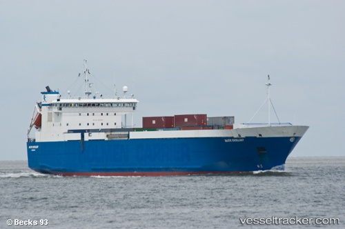
 AYA M
AYA M
Current Status
Where is the vessel?
AYA M is currently in 18 nm E of Moúdhros, based on AIS data received less than 1h ago.
Latest AIS update:
Current position: 39.77715° N, 25.64418° E (18 nm E of Moúdhros)
Average speed (last 7 days): Loading…
Average speed (last 30 days): Loading…
Vessel profile: AYA M is a Ro-Ro Cargo Ship with dimensions 125m x 24m.
This page combines live AIS, route history, probable destination signals, nearby traffic, and port activity for practical vessel monitoring.
The current position of vessel AYA M is 39.77715 lat / 25.64418 lng. Updated: 2026-05-15 16:10:53 UTCNearest reference points:
- 14 nm SW of Bozcaada
- 14 nm NW of Baba Point
- 16 nm NW of Sigri Lesvou
Currently sailing under the flag of Panama ![]()
AYA M built in 1995 year
Deadweight:
6293 tDetails:
Live Vessel AYA M Analytics (details, animations, etc.)
Recent AIS points (UTC):
2026-05-15 11:39:42 UTC · 40.29682, 26.56376 · SOG 12.9 kn · COG 231°2026-05-15 13:39:33 UTC · 40.02759, 26.18489 · SOG 13.5 kn · COG 266°
2026-05-15 14:01:34 UTC · 40.02022, 26.07965 · SOG 13.2 kn · COG 267°
2026-05-15 16:10:53 UTC · 39.77715, 25.64418 · SOG 12.1 kn · COG 215°