 SILVER SKY
Current Status
Where is the vessel?
SILVER SKY is currently in 152 nm SW of Fort Hunter Liggett, based on AIS data received about 15h ago.
Latest AIS update:
Current position: 34.51173° N, 124.39093° W (152 nm SW of Fort Hunter Liggett)
Average speed (last 7 days): Loading…
Average speed (last 30 days): Loading…
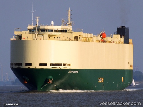
Vessel profile: SILVER SKY is a Vehicles Carrier with dimensions 183m x 32m.
This page combines live AIS, route history, probable destination signals, nearby traffic, and port activity for practical vessel monitoring.
The current position of vessel SILVER SKY is 34.51173 lat / -124.39093 lng. Updated: 2026-06-14 20:14:30 UTCCurrently sailing under the flag of Panama ![]()
SILVER SKY built in 2010 year
Deadweight:
12300 tDetails:
Live Vessel SILVER SKY Analytics (details, animations, etc.)
Recent AIS points (UTC):
2026-06-14 16:51:06 UTC · 34.51248, -123.28237 · SOG 16.4 kn · COG 267°2026-06-14 17:45:11 UTC · 34.51057, -123.58158 · SOG 16.4 kn · COG 268°
2026-06-14 19:55:12 UTC · 34.51162, -124.28610 · SOG 16.1 kn · COG 270°
2026-06-14 20:14:30 UTC · 34.51173, -124.39093 · SOG 16.1 kn · COG 270°