 STRENGTH
Current Status
Where is the vessel?
STRENGTH is currently in 41 nm NE of Cavle, based on AIS data received about 15h ago.
Latest AIS update:
Current position: 45.78500° N, 143.92000° E (41 nm NE of Cavle)
Average speed (last 7 days): Loading…
Average speed (last 30 days): Loading…
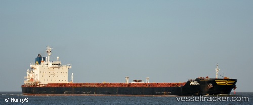
Vessel profile: STRENGTH is a Bulk Carrier with dimensions m x m.
This page combines live AIS, route history, probable destination signals, nearby traffic, and port activity for practical vessel monitoring.
The current position of vessel STRENGTH is 45.78500 lat / 143.92000 lng. Updated: 2026-05-19 16:25:23 UTCNearest reference points:
- 45 nm SE of PRIGORODNOYE
- 40 nm N of Cavle
- 40 nm SW of Launsdorf
Currently sailing under the flag of Panama ![]()
Details:
Live Vessel STRENGTH Analytics (details, animations, etc.)
Recent AIS points (UTC):
2026-05-19 13:47:52 UTC · 45.66970, 143.21133 · SOG 11.9 kn · COG 82°2026-05-19 13:47:52 UTC · 45.66970, 143.21133 · SOG 11.9 kn · COG 82°
2026-05-19 15:40:25 UTC · 45.73500, 143.73666 · SOG 11 kn · COG -1°
2026-05-19 16:25:23 UTC · 45.78500, 143.92000 · SOG 13 kn · COG -1°