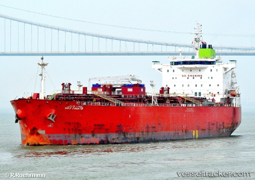
 GULF FANATIR
Current Status
Where is the vessel?
GULF FANATIR is currently in 248 nm NE of Trincomalee, based on AIS data received about 1d ago.
Latest AIS update:
Current position: 11.01355° N, 84.59021° E (248 nm NE of Trincomalee)
Average speed (last 7 days): Loading…
Average speed (last 30 days): Loading…
Vessel profile: GULF FANATIR is a Oil/Chemical Tanker with dimensions m x m.
This page combines live AIS, route history, probable destination signals, nearby traffic, and port activity for practical vessel monitoring.
The current position of vessel GULF FANATIR is 11.01355 lat / 84.59021 lng. Updated: 2026-06-30 22:24:06 UTCCurrently sailing under the flag of Panama ![]()
Details:
Live Vessel GULF FANATIR Analytics (details, animations, etc.)
Recent AIS points (UTC):
2026-06-30 22:24:06 UTC · 11.01355, 84.59021 · SOG 12.8 kn · COG -1°2026-06-30 22:24:06 UTC · 11.01355, 84.59021 · SOG 12.8 kn · COG -1°
2026-06-30 22:24:06 UTC · 11.01355, 84.59021 · SOG 12.8 kn · COG -1°
2026-06-30 22:24:06 UTC · 11.01355, 84.59021 · SOG 12.8 kn · COG -1°