 BHARAT
Current Status
Where is the vessel?
BHARAT is currently in Near Dunkerque, based on AIS data received about 14h ago.
Latest AIS update:
Current position: 51.04624° N, 2.35009° E (Near Dunkerque)
Average speed (last 7 days): Loading…
Average speed (last 30 days): Loading…
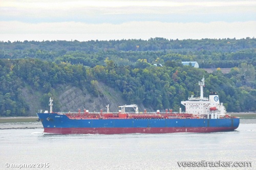
Vessel profile: BHARAT is a Chemical Oil Products Tanker with dimensions 177m x 176m.
This page combines live AIS, route history, probable destination signals, nearby traffic, and port activity for practical vessel monitoring.
The current position of vessel BHARAT is 51.04624 lat / 2.35009 lng. Updated: 2026-05-20 06:04:35 UTCNearest reference points:
- Near Dunkerque
- Near ARQUES
- Near Lombardsijde
Currently sailing under the flag of Panama ![]()
BHARAT built in 2003 year
Deadweight:
40128 tDetails:
Live Vessel BHARAT Analytics (details, animations, etc.)
Recent AIS points (UTC):
2026-05-20 02:07:35 UTC · 51.04631, 2.35007 · SOG 0 kn · COG 229°2026-05-20 04:07:35 UTC · 51.04628, 2.35003 · SOG 0 kn · COG 229°
2026-05-20 04:40:35 UTC · 51.04626, 2.35007 · SOG 0 kn · COG 229°
2026-05-20 06:04:35 UTC · 51.04624, 2.35009 · SOG 0 kn · COG 229°