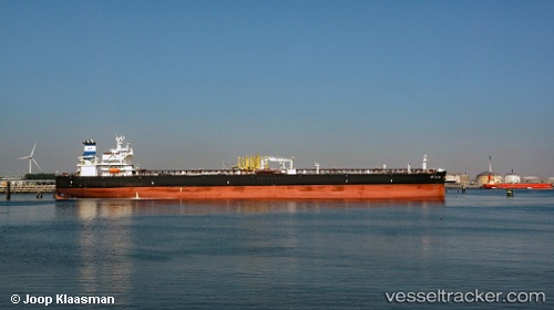
 VST OCEANIA
Current Status
Where is the vessel?
VST OCEANIA is currently in 15 nm S of Malacca, based on AIS data received about 15h ago.
Latest AIS update:
Current position: 1.93547° N, 102.31077° E (15 nm S of Malacca)
Average speed (last 7 days): Loading…
Average speed (last 30 days): Loading…
Vessel profile: VST OCEANIA is a Tanker with dimensions m x m.
This page combines live AIS, route history, probable destination signals, nearby traffic, and port activity for practical vessel monitoring.
The current position of vessel VST OCEANIA is 1.93547 lat / 102.31077 lng. Updated: 2026-05-20 19:13:21 UTCNearest reference points:
- Near Malacca
- 12 nm S of Tangkak
- Near MELAKA
Currently sailing under the flag of Panama ![]()
Details:
Live Vessel VST OCEANIA Analytics (details, animations, etc.)
Recent AIS points (UTC):
2026-05-20 15:58:51 UTC · 1.67508, 102.87725 · SOG 10.8 kn · COG 284°2026-05-20 16:33:11 UTC · 1.71150, 102.78126 · SOG 11 kn · COG 305°
2026-05-20 17:39:01 UTC · 1.81201, 102.60494 · SOG 11.4 kn · COG 294°
2026-05-20 19:13:21 UTC · 1.93547, 102.31077 · SOG 12.8 kn · COG 289°