 CELESTIA
Current Status
Where is the vessel?
CELESTIA is currently in Near Hulhulé Island, based on AIS data received about 14h ago.
Latest AIS update:
Current position: 4.18092° N, 73.50591° E (Near Hulhulé Island)
Average speed (last 7 days): Loading…
Average speed (last 30 days): Loading…
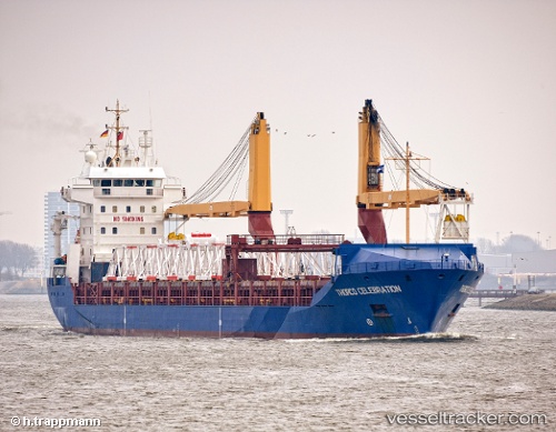
Vessel profile: CELESTIA is a General Cargo Ship with dimensions 143m x 18m.
This page combines live AIS, route history, probable destination signals, nearby traffic, and port activity for practical vessel monitoring.
The current position of vessel CELESTIA is 4.18092 lat / 73.50591 lng. Updated: 2026-06-25 02:02:20 UTCNearest reference points:
- Near Maamigili Port
Currently sailing under the flag of Panama ![]()
CELESTIA built in 2002 year
Deadweight:
10325 tDetails:
Live Vessel CELESTIA Analytics (details, animations, etc.)
Recent AIS points (UTC):
2026-06-24 22:29:21 UTC · 4.18093, 73.50593 · SOG 0 kn · COG 248°2026-06-25 00:05:21 UTC · 4.18091, 73.50593 · SOG 0 kn · COG 248°
2026-06-25 01:14:21 UTC · 4.18091, 73.50590 · SOG 0 kn · COG 248°
2026-06-25 02:02:20 UTC · 4.18092, 73.50591 · SOG 0 kn · COG 248°