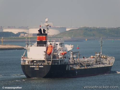
Chemstar Masa
Current StatusWhere is the vessel?
Chemstar Masa is currently in 155 nm NE of Suqutrá, based on AIS data received about 14h ago.
Latest AIS update:
Current position: 14.35765° N, 55.84260° E (155 nm NE of Suqutrá)
Average speed (last 7 days): Loading…
Average speed (last 30 days): Loading…
Vessel profile: Chemstar Masa is a Chemical Oil Products Tanker with dimensions 24m x 148m.
This page combines live AIS, route history, probable destination signals, nearby traffic, and port activity for practical vessel monitoring.
The current position of vessel Chemstar Masa is 14.35765 lat / 55.84260 lng. Updated: 2026-06-14 15:49:44 UTCNearest reference points:
- 103 nm S of Port Raysut
- 110 nm NE of Gross Koris
- 106 nm S of Port Raysut
Details:
Live Vessel Chemstar Masa Analytics (details, animations, etc.)
Recent AIS points (UTC):
2026-06-14 13:28:29 UTC · 14.28365, 56.23267 · SOG 9.5 kn · COG 282°2026-06-14 13:28:29 UTC · 14.28365, 56.23267 · SOG 9.5 kn · COG 282°
2026-06-14 15:49:44 UTC · 14.35765, 55.84260 · SOG 9.8 kn · COG 266°
2026-06-14 15:49:44 UTC · 14.35765, 55.84260 · SOG 9.8 kn · COG 266°