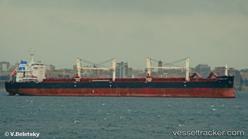
Clear Sky
Current StatusWhere is the vessel?
Clear Sky is currently in 126 nm N of Caleta de Sebo, based on AIS data received about 15h ago.
Latest AIS update:
Current position: 31.17206° N, 14.41282° W (126 nm N of Caleta de Sebo)
Average speed (last 7 days): Loading…
Average speed (last 30 days): Loading…
Vessel profile: Clear Sky is a Bulk Carrier with dimensions 32m x 200m.
This page combines live AIS, route history, probable destination signals, nearby traffic, and port activity for practical vessel monitoring.
The current position of vessel Clear Sky is 31.17206 lat / -14.41282 lng. Updated: 2026-05-22 12:19:09 UTCNearest reference points:
- 148 nm SE of Porto Santo Island
- 120 nm N of Bañaderos
- 83 nm N of Caleta de Sebo
Details:
Live Vessel Clear Sky Analytics (details, animations, etc.)
Recent AIS points (UTC):
2026-05-22 08:10:28 UTC · 30.48176, -14.51024 · SOG 10 kn · COG 10°2026-05-22 09:51:08 UTC · 30.76398, -14.47431 · SOG 10.3 kn · COG 7°
2026-05-22 10:05:28 UTC · 30.80505, -14.46849 · SOG 10.3 kn · COG 7°
2026-05-22 12:19:09 UTC · 31.17206, -14.41282 · SOG 9.6 kn · COG 5°