 vesseltracker.com
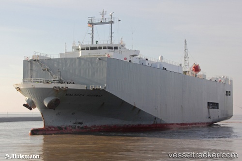
 Malacca Highway
Current Status
Where is the vessel?
Malacca Highway is currently in 25 nm N of GETARIA, based on AIS data received less than 1h ago.
Latest AIS update:
Current position: 43.71971° N, 2.18811° W (25 nm N of GETARIA)
Average speed (last 7 days): Loading…
Average speed (last 30 days): Loading…
Vessel profile: Malacca Highway is a Vehicles Carrier with dimensions 139m x 23m.
This page combines live AIS, route history, probable destination signals, nearby traffic, and port activity for practical vessel monitoring.
The current position of vessel Malacca Highway is 43.71971 lat / -2.18811 lng. Updated: 2026-04-26 08:13:22 UTCNearest reference points:
- Near ONDARROA
- Near Guizaburuaga
- Near HENDAYE
Currently sailing under the flag of Panama ![]()
Malacca Highway built in 2001 year
Deadweight:
6864 tDetails:
Live Vessel Malacca Highway Analytics (details, animations, etc.)
Recent AIS points (UTC):
2026-04-26 04:14:20 UTC · 43.32219, -1.90666 · SOG 0 kn · COG -1°2026-04-26 05:29:41 UTC · 43.32220, -1.90666 · SOG 0 kn · COG 60°
2026-04-26 07:42:58 UTC · 43.59356, -2.10076 · SOG 16.9 kn · COG 334°
2026-04-26 08:13:22 UTC · 43.71971, -2.18811 · SOG 16.4 kn · COG 335°