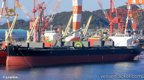
Indigo River
Current StatusWhere is the vessel?
Indigo River is currently in Near Yokkaichi, based on AIS data received about 14h ago.
Latest AIS update:
Current position: 34.95402° N, 136.64413° E (Near Yokkaichi)
Average speed (last 7 days): Loading…
Average speed (last 30 days): Loading…
Vessel profile: Indigo River is a General Cargo Ship with dimensions 32m x 190m.
This page combines live AIS, route history, probable destination signals, nearby traffic, and port activity for practical vessel monitoring.
The current position of vessel Indigo River is 34.95402 lat / 136.64413 lng. Updated: 2026-06-25 04:58:34 UTCNearest reference points:
- Near Yokkaichi
- Near Nagoya
- Near Kinuura
Details:
Live Vessel Indigo River Analytics (details, animations, etc.)
Recent AIS points (UTC):
2026-06-25 02:15:11 UTC · 34.95333, 136.64333 · SOG 0 kn · COG -1°2026-06-25 02:16:32 UTC · 34.95400, 136.64413 · SOG 0 kn · COG 285°
2026-06-25 04:13:29 UTC · 34.95405, 136.64410 · SOG 0 kn · COG 285°
2026-06-25 04:58:34 UTC · 34.95402, 136.64413 · SOG 0 kn · COG 285°