 vesseltracker.com
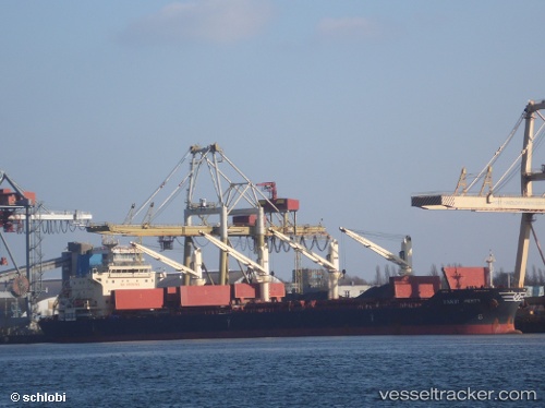
Handy Perth
Current StatusWhere is the vessel?
Handy Perth is currently in 28 nm S of Seaford, based on AIS data received less than 1h ago.
Latest AIS update:
Current position: 50.32061° N, 0.13578° W (28 nm S of Seaford)
Average speed (last 7 days): Loading…
Average speed (last 30 days): Loading…
Vessel profile: Handy Perth is a Bulk Carrier with dimensions 30m x 180m.
This page combines live AIS, route history, probable destination signals, nearby traffic, and port activity for practical vessel monitoring.
The current position of vessel Handy Perth is 50.32061 lat / -0.13578 lng. Updated: 2026-05-13 23:32:09 UTCNearest reference points:
- 27 nm S of Seaford
- 23 nm S of Ferring
- 15 nm S of Selsey
Details:
Live Vessel Handy Perth Analytics (details, animations, etc.)
Recent AIS points (UTC):
2026-05-13 19:40:20 UTC · 50.09909, -1.26393 · SOG 12.6 kn · COG 69°2026-05-13 22:08:59 UTC · 50.24713, -0.54710 · SOG 11.7 kn · COG 75°
2026-05-13 22:17:20 UTC · 50.25458, -0.50591 · SOG 11.7 kn · COG 75°
2026-05-13 23:32:09 UTC · 50.32061, -0.13578 · SOG 11.9 kn · COG 75°