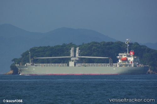
Tropical Bintang
Current StatusWhere is the vessel?
Tropical Bintang is currently in Near Port Klang (Ferry Port), based on AIS data received about 15h ago.
Latest AIS update:
Current position: 3.04745° N, 101.35626° E (Near Port Klang (Ferry Port))
Average speed (last 7 days): Loading…
Average speed (last 30 days): Loading…
Vessel profile: Tropical Bintang is a General Cargo Ship with dimensions 21m x 120m.
This page combines live AIS, route history, probable destination signals, nearby traffic, and port activity for practical vessel monitoring.
The current position of vessel Tropical Bintang is 3.04745 lat / 101.35626 lng. Updated: 2026-07-26 23:43:13 UTCNearest reference points:
- Near Port Klang (Ferry Port)
- Near Kapar
- Near Port Swettenham
Details:
Live Vessel Tropical Bintang Analytics (details, animations, etc.)
Recent AIS points (UTC):
2026-07-26 19:40:35 UTC · 2.81582, 101.28736 · SOG 0.1 kn · COG 102°2026-07-26 21:48:55 UTC · 3.04751, 101.35450 · SOG 1.2 kn · COG 21°
2026-07-26 22:58:15 UTC · 3.04746, 101.35630 · SOG 0.1 kn · COG 358°
2026-07-26 23:43:13 UTC · 3.04745, 101.35626 · SOG 0 kn · COG 358°