 vesseltracker.com
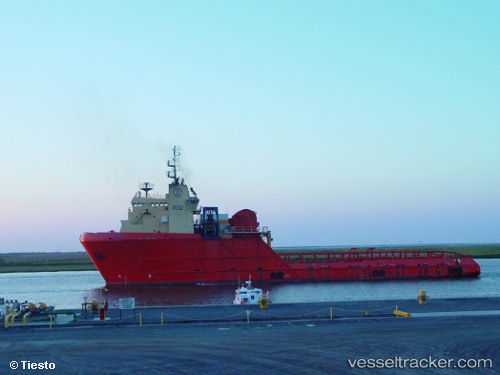
 Gary Chouest
Current Status
Where is the vessel?
Gary Chouest is currently in Near Little Creek, based on AIS data received less than 1h ago.
Latest AIS update:
Current position: 36.92000° N, 76.18191° W (Near Little Creek)
Average speed (last 7 days): Loading…
Average speed (last 30 days): Loading…
Vessel profile: Gary Chouest is a Offshore Tug Supply Ship with dimensions 84m x 84m.
This page combines live AIS, route history, probable destination signals, nearby traffic, and port activity for practical vessel monitoring.
The current position of vessel Gary Chouest is 36.92000 lat / -76.18191 lng. Updated: 2026-05-16 02:34:48 UTCNearest reference points:
- Near Little Creek
- Near Sewell's Point
- Near Norfolk
Currently sailing under the flag of USA ![]()
Gary Chouest built in 1998 year
Deadweight:
4131 tDetails:
Live Vessel Gary Chouest Analytics (details, animations, etc.)
Recent AIS points (UTC):
2026-05-15 22:29:19 UTC · 36.91833, -76.18167 · SOG 0 kn · COG -1°2026-05-15 23:53:17 UTC · 36.91833, -76.18167 · SOG 0 kn · COG -1°
2026-05-16 01:37:48 UTC · 36.91994, -76.18189 · SOG 0 kn · COG 90°
2026-05-16 02:34:48 UTC · 36.92000, -76.18191 · SOG 0 kn · COG 89°