 LUTHER
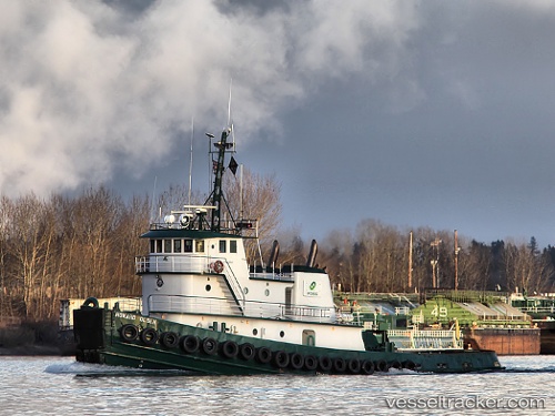
Current Status
Where is the vessel?
LUTHER is currently in 43 nm SE of Santa Rosa Island, based on AIS data received about 15h ago.
Latest AIS update:
Current position: 33.29225° N, 119.76965° W (43 nm SE of Santa Rosa Island)
Average speed (last 7 days): Loading…
Average speed (last 30 days): Loading…
Vessel profile: LUTHER is a Tug with dimensions m x m.
This page combines live AIS, route history, probable destination signals, nearby traffic, and port activity for practical vessel monitoring.
The current position of vessel LUTHER is 33.29225 lat / -119.76965 lng. Updated: 2026-05-20 05:23:42 UTCNearest reference points:
- Near CHANNEL ISLANDS
- Near Hueneme
- Near Santa Barbara
Currently sailing under the flag of United States ![]()
Details:
Live Vessel LUTHER Analytics (details, animations, etc.)
Recent AIS points (UTC):
2026-05-20 02:37:22 UTC · 33.51700, -119.94862 · SOG 9.3 kn · COG 129°2026-05-20 04:13:52 UTC · 33.38419, -119.82077 · SOG 4.8 kn · COG 148°
2026-05-20 05:03:42 UTC · 33.31802, -119.78615 · SOG 4.9 kn · COG 144°
2026-05-20 05:23:42 UTC · 33.29225, -119.76965 · SOG 5.5 kn · COG 144°