 Ata
Ata
Current Status
Where is the vessel?
Ata is currently in Near BAKIRKOY, based on AIS data received about 14h ago.
Latest AIS update:
Current position: 40.95716° N, 28.86897° E (Near BAKIRKOY)
Average speed (last 7 days): Loading…
Average speed (last 30 days): Loading…
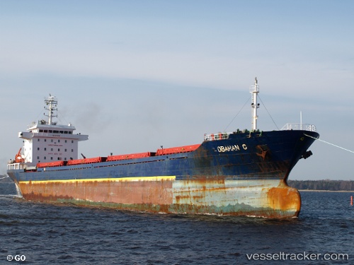
Vessel profile: Ata is a Bulk Carrier with dimensions 150m x 22m.
This page combines live AIS, route history, probable destination signals, nearby traffic, and port activity for practical vessel monitoring.
The current position of vessel Ata is 40.95716 lat / 28.86897 lng. Updated: 2026-07-03 20:04:57 UTCNearest reference points:
- Near BAKIRKOY
- Near ZEYTINBURNU
- Near Davutpasa
Currently sailing under the flag of Panama ![]()
Ata built in 2009 year
Deadweight:
17795 tDetails:
Live Vessel Ata Analytics (details, animations, etc.)
Recent AIS points (UTC):
2026-07-03 16:41:04 UTC · 40.95678, 28.86926 · SOG 0.1 kn · COG 255°2026-07-03 18:10:58 UTC · 40.95634, 28.86908 · SOG 0.1 kn · COG 285°
2026-07-03 19:35:00 UTC · 40.95639, 28.86913 · SOG 0 kn · COG 282°
2026-07-03 20:04:57 UTC · 40.95716, 28.86897 · SOG 0 kn · COG 237°