 vesseltracker.com
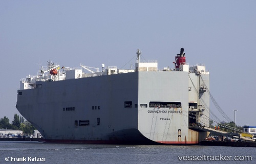
Guangzou Highway
Current StatusWhere is the vessel?
Guangzou Highway is currently in Near Kukdo, based on AIS data received about 1h ago.
Latest AIS update:
Current position: 34.48965° N, 128.54283° E (Near Kukdo)
Average speed (last 7 days): Loading…
Average speed (last 30 days): Loading…
Vessel profile: Guangzou Highway is a Vehicles Carrier with dimensions 40m x 180m.
This page combines live AIS, route history, probable destination signals, nearby traffic, and port activity for practical vessel monitoring.
The current position of vessel Guangzou Highway is 34.48965 lat / 128.54283 lng. Updated: 2026-04-09 11:26:25 UTCNearest reference points:
- 15 nm S of Kukdo
- 14 nm E of Kukdo
- 10 nm SW of Junghwa
Details:
Live Vessel Guangzou Highway Analytics (details, animations, etc.)
Recent AIS points (UTC):
2026-04-09 05:48:25 UTC · 34.05458, 126.77881 · SOG 15.7 kn · COG 90°2026-04-09 07:51:27 UTC · 34.12826, 127.42571 · SOG 15.5 kn · COG 80°
2026-04-09 10:20:55 UTC · 34.37570, 128.20538 · SOG 16.7 kn · COG 68°
2026-04-09 11:26:25 UTC · 34.48965, 128.54283 · SOG 16.4 kn · COG 69°