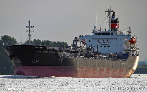
 Chemstar Tierra
Current Status
Where is the vessel?
Chemstar Tierra is currently in Near Port-Alfred, based on AIS data received about 15h ago.
Latest AIS update:
Current position: 48.33449° N, 70.86986° W (Near Port-Alfred)
Average speed (last 7 days): Loading…
Average speed (last 30 days): Loading…
Vessel profile: Chemstar Tierra is a Chemical Oil Products Tanker with dimensions 149m x 24m.
This page combines live AIS, route history, probable destination signals, nearby traffic, and port activity for practical vessel monitoring.
The current position of vessel Chemstar Tierra is 48.33449 lat / -70.86986 lng. Updated: 2026-05-21 00:13:25 UTCNearest reference points:
- Near Ile Aux Coudres
- Near QUEBEC
- 15 nm NW of Saint-Anaclet
Currently sailing under the flag of Panama ![]()
Details:
Live Vessel Chemstar Tierra Analytics (details, animations, etc.)
Recent AIS points (UTC):
2026-05-20 19:10:25 UTC · 48.33456, -70.86987 · SOG 0 kn · COG 262°2026-05-20 21:55:25 UTC · 48.33452, -70.86994 · SOG 0 kn · COG 262°
2026-05-20 23:10:25 UTC · 48.33454, -70.86993 · SOG 0 kn · COG 262°
2026-05-21 00:13:25 UTC · 48.33449, -70.86986 · SOG 0 kn · COG 262°