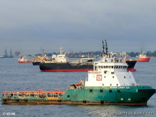
 BOURBON LIBERTY 225
Current Status
Where is the vessel?
BOURBON LIBERTY 225 is currently in 103 nm N of Pulau Bruit, based on AIS data received about 16h ago.
Latest AIS update:
Current position: 4.28833° N, 111.55500° E (103 nm N of Pulau Bruit)
Average speed (last 7 days): Loading…
Average speed (last 30 days): Loading…
Vessel profile: BOURBON LIBERTY 225 is a Anchor Handling Vessel with dimensions m x m.
This page combines live AIS, route history, probable destination signals, nearby traffic, and port activity for practical vessel monitoring.
The current position of vessel BOURBON LIBERTY 225 is 4.28833 lat / 111.55500 lng. Updated: 2026-07-04 08:50:41 UTCNearest reference points:
- 42 nm W of BINTULU
- 28 nm SW of BINTULU
- Near BINTULU
Currently sailing under the flag of Saint Vincent and the Grenadines ![]()
Details:
Live Vessel BOURBON LIBERTY 225 Analytics (details, animations, etc.)
Recent AIS points (UTC):
2026-07-04 07:32:46 UTC · 4.28833, 111.55500 · SOG 0 kn · COG -1°2026-07-04 07:32:46 UTC · 4.28833, 111.55500 · SOG 0 kn · COG -1°
2026-07-04 08:50:41 UTC · 4.28833, 111.55500 · SOG 0 kn · COG -1°
2026-07-04 08:50:41 UTC · 4.28833, 111.55500 · SOG 0 kn · COG -1°