 BEQUIA EXPRESS 5
Current Status
Where is the vessel?
BEQUIA EXPRESS 5 is currently in Near BEQUIA, based on AIS data received about 4d ago.
Latest AIS update:
Current position: 13.01167° N, 61.23667° W (Near BEQUIA)
Average speed (last 7 days): Loading…
Average speed (last 30 days): Loading…
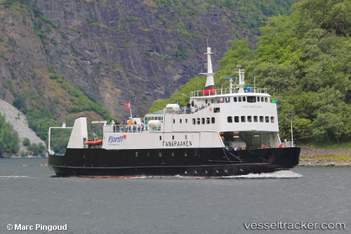
Vessel profile: BEQUIA EXPRESS 5 is a Ro-Ro/Passenger Ship with dimensions m x m.
This page combines live AIS, route history, probable destination signals, nearby traffic, and port activity for practical vessel monitoring.
The current position of vessel BEQUIA EXPRESS 5 is 13.01167 lat / -61.23667 lng. Updated: 2026-06-20 11:41:15 UTCNearest reference points:
- Near Kingstown
- 16 nm SW of Carriacou Apt
- Near St. Georges
Currently sailing under the flag of Saint Vincent and the Grenadines ![]()
Details:
Live Vessel BEQUIA EXPRESS 5 Analytics (details, animations, etc.)
Recent AIS points (UTC):
2026-06-20 11:41:15 UTC · 13.01167, -61.23667 · SOG 0 kn · COG -1°2026-06-20 11:41:15 UTC · 13.01167, -61.23667 · SOG 0 kn · COG -1°
2026-06-20 11:41:15 UTC · 13.01167, -61.23667 · SOG 0 kn · COG -1°
2026-06-20 11:41:15 UTC · 13.01167, -61.23667 · SOG 0 kn · COG -1°