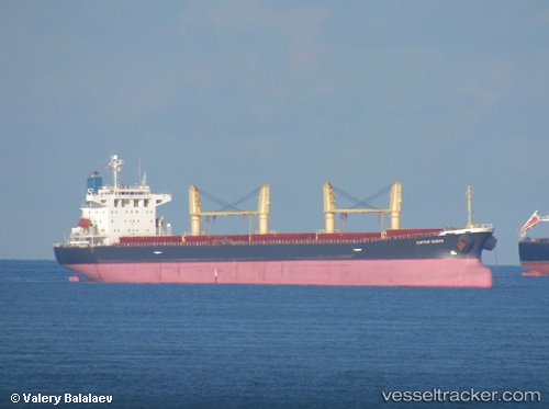
Xie Hai Yong Ning
Current StatusWhere is the vessel?
Xie Hai Yong Ning is currently in 22 nm E of Changdao, based on AIS data received about 15h ago.
Latest AIS update:
Current position: 37.90837° N, 121.18759° E (22 nm E of Changdao)
Average speed (last 7 days): Loading…
Average speed (last 30 days): Loading…
Vessel profile: Xie Hai Yong Ning is a Bulk Carrier with dimensions 31m x 183m.
This page combines live AIS, route history, probable destination signals, nearby traffic, and port activity for practical vessel monitoring.
The current position of vessel Xie Hai Yong Ning is 37.90837 lat / 121.18759 lng. Updated: 2026-06-23 19:42:46 UTCNearest reference points:
- 16 nm E of Changdao
- 14 nm NW of Yantai
- 29 nm S of Lushun New Pt
Details:
Live Vessel Xie Hai Yong Ning Analytics (details, animations, etc.)
Recent AIS points (UTC):
2026-06-23 16:05:46 UTC · 38.10129, 120.31562 · SOG 11.6 kn · COG 123°2026-06-23 18:25:06 UTC · 37.97642, 120.87825 · SOG 12 kn · COG 101°
2026-06-23 19:39:16 UTC · 37.91208, 121.17412 · SOG 11.5 kn · COG 109°
2026-06-23 19:42:46 UTC · 37.90837, 121.18759 · SOG 11.5 kn · COG 108°