 vesseltracker.com
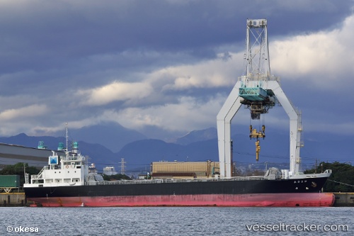
Tetsuryu Maru
Current StatusWhere is the vessel?
Tetsuryu Maru is currently in Near Oita, based on AIS data received about 1d ago.
Latest AIS update:
Current position: 33.28667° N, 131.61166° E (Near Oita)
Average speed (last 7 days): Loading…
Average speed (last 30 days): Loading…
Vessel profile: Tetsuryu Maru is a General Cargo Ship with dimensions 13m x 83m.
This page combines live AIS, route history, probable destination signals, nearby traffic, and port activity for practical vessel monitoring.
The current position of vessel Tetsuryu Maru is 33.28667 lat / 131.61166 lng. Updated: 2026-04-22 23:14:19 UTCNearest reference points:
- Near Oita
- Near Kitsuki
- 14 nm SW of HIKARI
Details:
Live Vessel Tetsuryu Maru Analytics (details, animations, etc.)
Recent AIS points (UTC):
2026-04-22 23:14:19 UTC · 33.28667, 131.61166 · SOG 13 kn · COG -1°2026-04-22 23:14:19 UTC · 33.28667, 131.61166 · SOG 13 kn · COG -1°
2026-04-22 23:14:19 UTC · 33.28667, 131.61166 · SOG 13 kn · COG -1°
2026-04-22 23:14:19 UTC · 33.28667, 131.61166 · SOG 13 kn · COG -1°