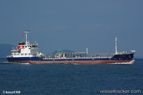
Riei Maru
Current StatusWhere is the vessel?
Riei Maru is currently in Near MIZUSHIMA, based on AIS data received about 14h ago.
Latest AIS update:
Current position: 34.45573° N, 133.66306° E (Near MIZUSHIMA)
Average speed (last 7 days): Loading…
Average speed (last 30 days): Loading…
Vessel profile: Riei Maru is a Oil Products Tanker with dimensions 13m x 76m.
This page combines live AIS, route history, probable destination signals, nearby traffic, and port activity for practical vessel monitoring.
The current position of vessel Riei Maru is 34.45573 lat / 133.66306 lng. Updated: 2026-06-24 08:18:20 UTCNearest reference points:
- Near Kurashiki
- Near MIZUSHIMA
- Near FUKUYAMA
Details:
Live Vessel Riei Maru Analytics (details, animations, etc.)
Recent AIS points (UTC):
2026-06-24 05:33:19 UTC · 34.45580, 133.66296 · SOG 0 kn · COG 63°2026-06-24 06:33:17 UTC · 34.45583, 133.66296 · SOG 0 kn · COG 64°
2026-06-24 07:42:16 UTC · 34.45575, 133.66298 · SOG 0 kn · COG 62°
2026-06-24 08:18:20 UTC · 34.45573, 133.66306 · SOG 0 kn · COG 57°