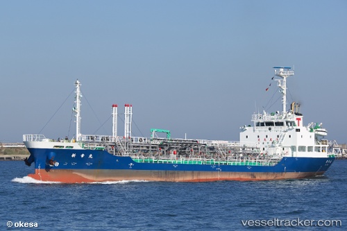
Shinko Maru
Current StatusWhere is the vessel?
Shinko Maru is currently in 16 nm NW of Nishitokyo, based on AIS data received about 15h ago.
Latest AIS update:
Current position: 34.96807° N, 139.37256° E (16 nm NW of Nishitokyo)
Average speed (last 7 days): Loading…
Average speed (last 30 days): Loading…
Vessel profile: Shinko Maru is a Oil Products Tanker with dimensions 12m x 79m.
This page combines live AIS, route history, probable destination signals, nearby traffic, and port activity for practical vessel monitoring.
The current position of vessel Shinko Maru is 34.96807 lat / 139.37256 lng. Updated: 2026-05-23 02:01:56 UTCNearest reference points:
- 15 nm S of Zushi
- Near Nishitokyo
- Near Toshima/Tokyo
Details:
Live Vessel Shinko Maru Analytics (details, animations, etc.)
Recent AIS points (UTC):
2026-05-22 22:49:58 UTC · 35.42782, 139.75093 · SOG 12.8 kn · COG 233°2026-05-23 00:05:56 UTC · 35.19891, 139.75766 · SOG 12.7 kn · COG 215°
2026-05-23 01:23:47 UTC · 35.03554, 139.50351 · SOG 12.1 kn · COG 239°
2026-05-23 02:01:56 UTC · 34.96807, 139.37256 · SOG 11.7 kn · COG 239°