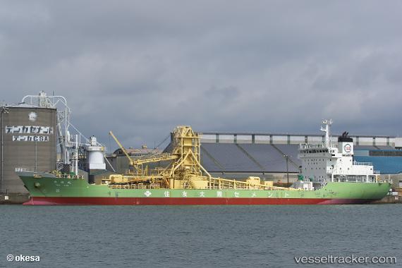
 Taiko Maru
Current Status
Where is the vessel?
Taiko Maru is currently in 26 nm S of Gobo Wakayama, based on AIS data received about 15h ago.
Latest AIS update:
Current position: 33.44768° N, 135.08368° E (26 nm S of Gobo Wakayama)
Average speed (last 7 days): Loading…
Average speed (last 30 days): Loading…
Vessel profile: Taiko Maru is a Cement Carrier with dimensions 118m x 18m.
This page combines live AIS, route history, probable destination signals, nearby traffic, and port activity for practical vessel monitoring.
The current position of vessel Taiko Maru is 33.44768 lat / 135.08368 lng. Updated: 2026-06-21 11:25:45 UTCNearest reference points:
- 12 nm S of Gobo Wakayama
- 18 nm SE of Gobo Wakayama
- 40 nm SW of Minachi
Currently sailing under the flag of Japan ![]()
Details:
Live Vessel Taiko Maru Analytics (details, animations, etc.)
Recent AIS points (UTC):
2026-06-21 07:07:58 UTC · 33.42990, 135.92249 · SOG 8.5 kn · COG 245°2026-06-21 10:20:35 UTC · 33.42480, 135.32832 · SOG 11.7 kn · COG 279°
2026-06-21 10:47:13 UTC · 33.42938, 135.22430 · SOG 11.6 kn · COG 281°
2026-06-21 11:25:45 UTC · 33.44768, 135.08368 · SOG 11.1 kn · COG 287°