 vesseltracker.com
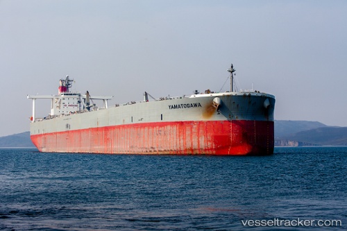
Vessel Yamatogawa IMO: 9313137, MMSI: 431386000 Crude Oil Tanker
UTC, 33.99748, 138.19855, course: -1, speed: 0.8
UTC, 33.97642, 138.19852, course: 115, speed: 0.6
2026-03-22 23:36:12 UTC, 33.95735, 138.20467, course: 130, speed: 0.7
Live Vessel Yamatogawa Analytics (details, animations, etc.)
Live AIS position: UTC. 40 nm S of OMAEZAKI), updated 2026-03-22 23:36:12 UTC.Find the position of the vessel Yamatogawa on the map. The latter are known coordinates and path.
marine traffic ship tracker show on live map
The current position of vessel Yamatogawa is 33.95735 lat / 138.20467 lng. Updated: 2026-03-22 23:36:12 UTCDetails:
Last coordinates of the vessel:
UTC, 34.01700, 138.21387, course: 139, speed: 0.5UTC, 33.99748, 138.19855, course: -1, speed: 0.8
UTC, 33.97642, 138.19852, course: 115, speed: 0.6
2026-03-22 23:36:12 UTC, 33.95735, 138.20467, course: 130, speed: 0.7