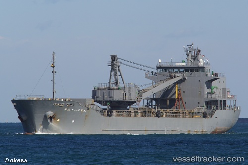
Shoei Maru No.58
Current StatusWhere is the vessel?
Shoei Maru No.58 is currently in Near Kochi, based on AIS data received about 14h ago.
Latest AIS update:
Current position: 33.50833° N, 133.58501° E (Near Kochi)
Average speed (last 7 days): Loading…
Average speed (last 30 days): Loading…
Vessel profile: Shoei Maru No.58 is a General Cargo Ship with dimensions 20m x 94m.
This page combines live AIS, route history, probable destination signals, nearby traffic, and port activity for practical vessel monitoring.
The current position of vessel Shoei Maru No.58 is 33.50833 lat / 133.58501 lng. Updated: 2026-05-25 07:51:38 UTCNearest reference points:
- Near Kochi
- Near NYUGAWA
- Near HAKATASHIMA
Details:
Live Vessel Shoei Maru No.58 Analytics (details, animations, etc.)
Recent AIS points (UTC):
2026-05-25 04:42:42 UTC · 33.48500, 133.61166 · SOG 0 kn · COG -1°2026-05-25 05:24:40 UTC · 33.48500, 133.61166 · SOG 0 kn · COG -1°
2026-05-25 07:27:39 UTC · 33.50833, 133.58501 · SOG 0 kn · COG -1°
2026-05-25 07:51:38 UTC · 33.50833, 133.58501 · SOG 0 kn · COG -1°