 vesseltracker.com
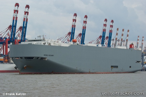
Bishu Highway
Current StatusWhere is the vessel?
Bishu Highway is currently in 60 nm S of Minachi, based on AIS data received less than 1h ago.
Latest AIS update:
Current position: 32.86443° N, 136.14073° E (60 nm S of Minachi)
Average speed (last 7 days): Loading…
Average speed (last 30 days): Loading…
Vessel profile: Bishu Highway is a Vehicles Carrier with dimensions 32m x 199m.
This page combines live AIS, route history, probable destination signals, nearby traffic, and port activity for practical vessel monitoring.
The current position of vessel Bishu Highway is 32.86443 lat / 136.14073 lng. Updated: 2026-05-16 14:05:12 UTCNearest reference points:
- 88 nm SE of Minachi
- 23 nm S of Minachi
- 40 nm SW of Minachi
Details:
Live Vessel Bishu Highway Analytics (details, animations, etc.)
Recent AIS points (UTC):
2026-05-16 10:06:36 UTC · 32.58226, 134.80450 · SOG 17.3 kn · COG 75°2026-05-16 11:52:07 UTC · 32.71347, 135.38049 · SOG 17.2 kn · COG 76°
2026-05-16 13:19:26 UTC · 32.81559, 135.87593 · SOG 17.9 kn · COG 76°
2026-05-16 14:05:12 UTC · 32.86443, 136.14073 · SOG 18.1 kn · COG 78°