 SONGRIM HO
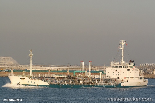
Current Status
Where is the vessel?
SONGRIM HO is currently in Near Ulsan, based on AIS data received about 15h ago.
Latest AIS update:
Current position: 35.49833° N, 129.36862° E (Near Ulsan)
Average speed (last 7 days): Loading…
Average speed (last 30 days): Loading…
Vessel profile: SONGRIM HO is a Oil/Chemical Tanker with dimensions m x m.
This page combines live AIS, route history, probable destination signals, nearby traffic, and port activity for practical vessel monitoring.
The current position of vessel SONGRIM HO is 35.49833 lat / 129.36862 lng. Updated: 2026-06-04 01:51:13 UTCNearest reference points:
- Near Ulsan
- Near Ilsan
- Near ONSAN
Currently sailing under the flag of South Korea ![]()
Details:
Live Vessel SONGRIM HO Analytics (details, animations, etc.)
Recent AIS points (UTC):
2026-06-03 22:02:23 UTC · 35.50183, 129.36749 · SOG 0 kn · COG 218°2026-06-04 00:29:43 UTC · 35.49810, 129.36865 · SOG 0.1 kn · COG 251°
2026-06-04 01:38:23 UTC · 35.49828, 129.36861 · SOG 0.1 kn · COG 251°
2026-06-04 01:51:13 UTC · 35.49833, 129.36862 · SOG 0.1 kn · COG 251°