 MORNING LADY
Current Status
Where is the vessel?
MORNING LADY is currently in Near Ube, based on AIS data received about 14h ago.
Latest AIS update:
Current position: 33.88094° N, 131.15350° E (Near Ube)
Average speed (last 7 days): Loading…
Average speed (last 30 days): Loading…
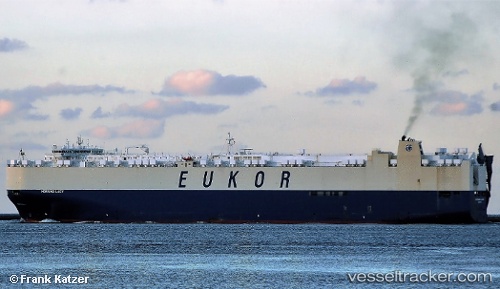
Vessel profile: MORNING LADY is a Vehicles Carrier with dimensions 34m x 234m.
This page combines live AIS, route history, probable destination signals, nearby traffic, and port activity for practical vessel monitoring.
The current position of vessel MORNING LADY is 33.88094 lat / 131.15350 lng. Updated: 2026-06-19 21:51:28 UTCNearest reference points:
- Near Ube
- Near KANDA
- Near Shimonoseki
Currently sailing under the flag of Korea (Republic of) ![]()
MORNING LADY built in 2010 year
Deadweight:
27343 tDetails:
Live Vessel MORNING LADY Analytics (details, animations, etc.)
Recent AIS points (UTC):
2026-06-19 17:52:14 UTC · 34.36507, 130.52588 · SOG 15.4 kn · COG 152°2026-06-19 19:33:56 UTC · 34.03187, 130.81419 · SOG 9.3 kn · COG 124°
2026-06-19 19:45:55 UTC · 34.01527, 130.84264 · SOG 6.2 kn · COG 127°
2026-06-19 21:51:28 UTC · 33.88094, 131.15350 · SOG 13 kn · COG 126°