 GLORY HANA
Current Status
Where is the vessel?
GLORY HANA is currently in Near OKAMURA, based on AIS data received about 14h ago.
Latest AIS update:
Current position: 34.16690° N, 132.92958° E (Near OKAMURA)
Average speed (last 7 days): Loading…
Average speed (last 30 days): Loading…
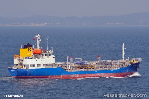
Vessel profile: GLORY HANA is a Oil/Chemical Tanker with dimensions m x m.
This page combines live AIS, route history, probable destination signals, nearby traffic, and port activity for practical vessel monitoring.
The current position of vessel GLORY HANA is 34.16690 lat / 132.92958 lng. Updated: 2026-05-23 02:02:28 UTCNearest reference points:
- Near Yoshiumi
- Near HAKATASHIMA
- Near ONOMICHIITOZAKI
Currently sailing under the flag of South Korea ![]()
Details:
Live Vessel GLORY HANA Analytics (details, animations, etc.)
Recent AIS points (UTC):
2026-05-22 22:49:57 UTC · 33.80886, 132.51459 · SOG 9.6 kn · COG 65°2026-05-23 00:05:58 UTC · 33.94053, 132.69016 · SOG 9 kn · COG 56°
2026-05-23 01:23:13 UTC · 34.09431, 132.84868 · SOG 10.3 kn · COG 43°
2026-05-23 02:02:28 UTC · 34.16690, 132.92958 · SOG 8.4 kn · COG 95°