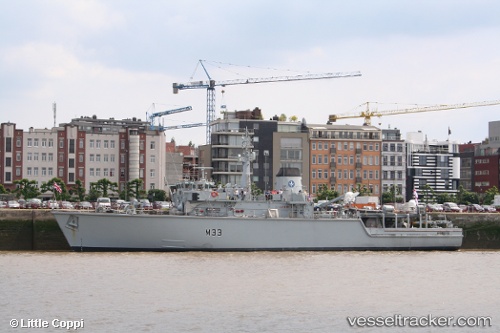
British Warship
Current StatusWhere is the vessel?
British Warship is currently in Near Fratton, based on AIS data received about 18d ago.
Latest AIS update:
Current position: 50.76178° N, 1.08844° W (Near Fratton)
Average speed (last 7 days): Loading…
Average speed (last 30 days): Loading…
Vessel profile: British Warship is a Naval Naval Auxiliary with dimensions 12m x 61m.
This page combines live AIS, route history, probable destination signals, nearby traffic, and port activity for practical vessel monitoring.
The current position of vessel British Warship is 50.76178 lat / -1.08844 lng. Updated: 2026-05-01 05:59:37 UTCNearest reference points:
- Near GOSPORT
- Near Portsmouth
- Near EASTNEY
Details:
Live Vessel British Warship Analytics (details, animations, etc.)
Recent AIS points (UTC):
2026-05-01 05:59:37 UTC · 50.76178, -1.08844 · SOG 11.6 kn · COG 346°