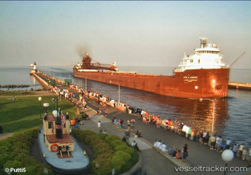
 Kaye E Barker
Current Status
Where is the vessel?
Kaye E Barker is currently in 15 nm E of Calcite, based on AIS data received about 15h ago.
Latest AIS update:
Current position: 45.36675° N, 83.42342° W (15 nm E of Calcite)
Average speed (last 7 days): Loading…
Average speed (last 30 days): Loading…
Vessel profile: Kaye E Barker is a Self Discharging Bulk Carrier with dimensions 223m x 21m.
This page combines live AIS, route history, probable destination signals, nearby traffic, and port activity for practical vessel monitoring.
The current position of vessel Kaye E Barker is 45.36675 lat / -83.42342 lng. Updated: 2026-06-03 10:27:32 UTCNearest reference points:
- Near Meldrum
- Near Mackinaw City
- Near Fort Gratiot
Currently sailing under the flag of USA ![]()
Kaye E Barker built in 1952 year
Deadweight:
25345 tDetails:
Live Vessel Kaye E Barker Analytics (details, animations, etc.)
Recent AIS points (UTC):
2026-06-03 07:05:43 UTC · 45.29758, -83.42179 · SOG 0 kn · COG 300°2026-06-03 08:08:22 UTC · 45.29756, -83.42173 · SOG 0 kn · COG 300°
2026-06-03 10:06:09 UTC · 45.30500, -83.41667 · SOG 7 kn · COG -1°
2026-06-03 10:27:32 UTC · 45.36675, -83.42342 · SOG 10.4 kn · COG 16°