 vesseltracker.com
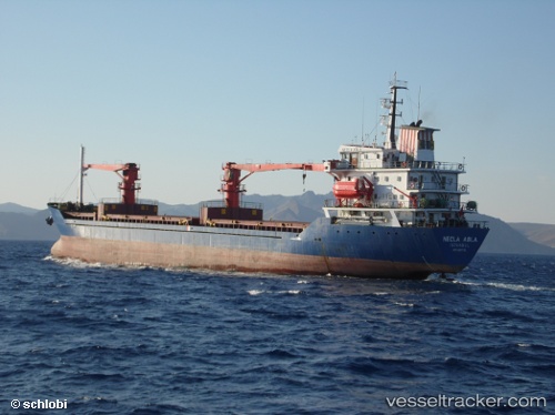
 ABLE
ABLE
Current Status
Where is the vessel?
ABLE is currently in Near Kumport, based on AIS data received less than 1h ago.
Latest AIS update:
Current position: 40.93991° N, 28.84042° E (Near Kumport)
Average speed (last 7 days): Loading…
Average speed (last 30 days): Loading…
Vessel profile: ABLE is a General Cargo Ship with dimensions 114m x 114m.
This page combines live AIS, route history, probable destination signals, nearby traffic, and port activity for practical vessel monitoring.
The current position of vessel ABLE is 40.93991 lat / 28.84042 lng. Updated: 2026-05-15 18:16:18 UTCNearest reference points:
- Near BAKIRKOY
- Near ZEYTINBURNU
- Near Kumport
Currently sailing under the flag of Palau (Republic of) ![]()
ABLE built in 1991 year
Deadweight:
7416 tDetails:
Live Vessel ABLE Analytics (details, animations, etc.)
Recent AIS points (UTC):
2026-05-15 14:01:29 UTC · 40.82616, 28.63584 · SOG 12 kn · COG 88°2026-05-15 16:10:42 UTC · 40.94024, 28.84062 · SOG 0 kn · COG 270°
2026-05-15 17:01:18 UTC · 40.94045, 28.84063 · SOG 0 kn · COG 254°
2026-05-15 18:16:18 UTC · 40.93991, 28.84042 · SOG 0 kn · COG 297°