 vesseltracker.com
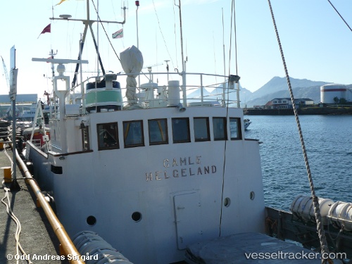
Gamle Helgeland
Current StatusWhere is the vessel?
Gamle Helgeland is currently in Near SANDNESSJOEN, based on AIS data received about 1511d ago.
Latest AIS update:
Current position: 66.02458° N, 12.63297° E (Near SANDNESSJOEN)
Average speed (last 7 days): Loading…
Average speed (last 30 days): Loading…
Vessel profile: Gamle Helgeland is a Passenger General Cargo Ship with dimensions 8m x 35m.
This page combines live AIS, route history, probable destination signals, nearby traffic, and port activity for practical vessel monitoring.
The current position of vessel Gamle Helgeland is 66.02458 lat / 12.63297 lng. Updated: 2022-03-29 11:22:00 UTCNearest reference points:
- Near STRAUMOYVALEN
- Near Vikholmen
- Near Lurøy
Details:
Live Vessel Gamle Helgeland Analytics (details, animations, etc.)
Recent AIS points (UTC):
2022-03-29 11:22:00 UTC · 66.02458, 12.63297 · SOG 0.2 kn · COG 0°