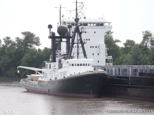
 SEA RANGER
Current Status
Where is the vessel?
SEA RANGER is currently in 34 nm S of El Albujon, based on AIS data received about 14h ago.
Latest AIS update:
Current position: 37.16179° N, 1.21199° E (34 nm S of El Albujon)
Average speed (last 7 days): Loading…
Average speed (last 30 days): Loading…
Vessel profile: SEA RANGER is a Yacht with dimensions m x m.
This page combines live AIS, route history, probable destination signals, nearby traffic, and port activity for practical vessel monitoring.
The current position of vessel SEA RANGER is 37.16179 lat / 1.21199 lng. Updated: 2026-06-21 04:35:44 UTCNearest reference points:
- 17 nm S of Albanchez
- 50 nm N of Mostaganem
- Near FORMENTERA
Currently sailing under the flag of Cook Islands ![]()
Details:
Live Vessel SEA RANGER Analytics (details, animations, etc.)
Recent AIS points (UTC):
2026-06-21 01:03:04 UTC · 37.31962, 1.94867 · SOG 10.2 kn · COG 252°2026-06-21 02:35:57 UTC · 37.26037, 1.62671 · SOG 10.3 kn · COG 256°
2026-06-21 04:29:45 UTC · 37.16679, 1.23289 · SOG 10.5 kn · COG 254°
2026-06-21 04:35:44 UTC · 37.16179, 1.21199 · SOG 10.4 kn · COG 254°