 vesseltracker.com
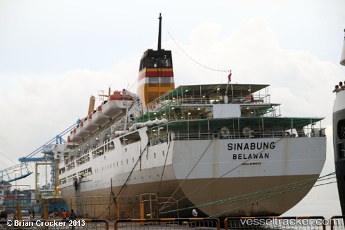
 Mv. Sinabung
Current Status
Where is the vessel?
Mv. Sinabung is currently in 26 nm NW of MANOKWARI, based on AIS data received about 1h ago.
Latest AIS update:
Current position: 0.59906° S, 133.73656° E (26 nm NW of MANOKWARI)
Average speed (last 7 days): Loading…
Average speed (last 30 days): Loading…
Vessel profile: Mv. Sinabung is a Passenger Ship with dimensions 146m x 22m.
This page combines live AIS, route history, probable destination signals, nearby traffic, and port activity for practical vessel monitoring.
The current position of vessel Mv. Sinabung is -0.59906 lat / 133.73656 lng. Updated: 2026-04-27 18:37:54 UTCNearest reference points:
- Near TANGGUH
- Near Sorong
Currently sailing under the flag of Indonesia ![]()
Mv. Sinabung built in 1997 year
Deadweight:
3485 tDetails:
Live Vessel Mv. Sinabung Analytics (details, animations, etc.)
Recent AIS points (UTC):
2026-04-27 15:50:44 UTC · -0.86922, 134.07591 · SOG 0 kn · COG 133°2026-04-27 16:04:05 UTC · -0.86930, 134.07584 · SOG 0.5 kn · COG 134°
2026-04-27 18:01:44 UTC · -0.64152, 133.88261 · SOG 15 kn · COG 290°
2026-04-27 18:37:54 UTC · -0.59906, 133.73656 · SOG 15.4 kn · COG 288°