 vesseltracker.com
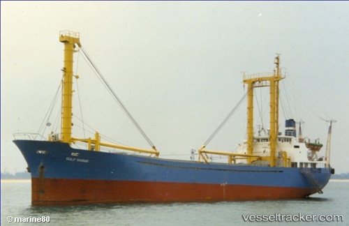
 GULF DAOUD
Current Status
Where is the vessel?
GULF DAOUD is currently in Near BADAS, based on AIS data received about 2h ago.
Latest AIS update:
Current position: 8.46097° S, 117.39498° E (Near BADAS)
Average speed (last 7 days): Loading…
Average speed (last 30 days): Loading…
Vessel profile: GULF DAOUD is a General Cargo Ship with dimensions 12m x 89m.
This page combines live AIS, route history, probable destination signals, nearby traffic, and port activity for practical vessel monitoring.
The current position of vessel GULF DAOUD is -8.46097 lat / 117.39498 lng. Updated: 2026-04-27 01:02:56 UTCNearest reference points:
- Near LEMBAR
- 30 nm N of BIMA
- 86 nm SE of BENETE
Currently sailing under the flag of Indonesia ![]()
GULF DAOUD built in 1983 year
Deadweight:
2419 tDetails:
Live Vessel GULF DAOUD Analytics (details, animations, etc.)
Recent AIS points (UTC):
2026-04-26 22:31:54 UTC · -8.46084, 117.39517 · SOG 0 kn · COG -1°2026-04-26 22:31:54 UTC · -8.46084, 117.39517 · SOG 0 kn · COG -1°
2026-04-27 01:02:56 UTC · -8.46097, 117.39498 · SOG 0.1 kn · COG -1°
2026-04-27 01:02:56 UTC · -8.46097, 117.39498 · SOG 0.1 kn · COG -1°