 KARUNIA GEMILANG I
Current Status
Where is the vessel?
KARUNIA GEMILANG I is currently in Near SURALAYA, based on AIS data received about 14h ago.
Latest AIS update:
Current position: 5.87419° S, 106.04668° E (Near SURALAYA)
Average speed (last 7 days): Loading…
Average speed (last 30 days): Loading…
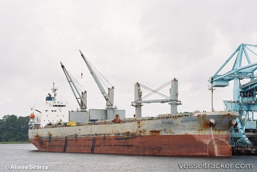
Vessel profile: KARUNIA GEMILANG I is a Bulk Carrier with dimensions 32m x 188m.
This page combines live AIS, route history, probable destination signals, nearby traffic, and port activity for practical vessel monitoring.
The current position of vessel KARUNIA GEMILANG I is -5.87419 lat / 106.04668 lng. Updated: 2026-05-22 13:02:02 UTCNearest reference points:
- Near SURALAYA
- Near MERAK
- Near Ardjuna
Currently sailing under the flag of Indonesia ![]()
KARUNIA GEMILANG I built in 2002 year
Deadweight:
53098 tDetails:
Live Vessel KARUNIA GEMILANG I Analytics (details, animations, etc.)
Recent AIS points (UTC):
2026-05-22 10:11:01 UTC · -5.87420, 106.04667 · SOG 0 kn · COG 269°2026-05-22 10:29:02 UTC · -5.87423, 106.04668 · SOG 0 kn · COG 269°
2026-05-22 12:17:02 UTC · -5.87420, 106.04668 · SOG 0 kn · COG 269°
2026-05-22 13:02:02 UTC · -5.87419, 106.04668 · SOG 0 kn · COG 269°