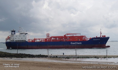
 GAS ROSEA
Current Status
Where is the vessel?
GAS ROSEA is currently in Near Gregory' Lake Apt (Nuwara Eliya), based on AIS data received about 15h ago.
Latest AIS update:
Current position: 8.48838° N, 81.22515° E (Near Gregory' Lake Apt (Nuwara Eliya))
Average speed (last 7 days): Loading…
Average speed (last 30 days): Loading…
Vessel profile: GAS ROSEA is a Tanker with dimensions m x m.
This page combines live AIS, route history, probable destination signals, nearby traffic, and port activity for practical vessel monitoring.
The current position of vessel GAS ROSEA is 8.48838 lat / 81.22515 lng. Updated: 2026-07-01 20:15:22 UTCNearest reference points:
- 67 nm E of Oluvil
- 42 nm E of Konwelana
- 40 nm E of Konwelana
Currently sailing under the flag of Indonesia ![]()
Details:
Live Vessel GAS ROSEA Analytics (details, animations, etc.)
Recent AIS points (UTC):
2026-07-01 16:10:35 UTC · 8.48845, 81.22508 · SOG 0.3 kn · COG 222°2026-07-01 17:26:05 UTC · 8.48804, 81.22540 · SOG 0.6 kn · COG 260°
2026-07-01 19:27:00 UTC · 8.48790, 81.22549 · SOG 0.1 kn · COG 247°
2026-07-01 20:15:22 UTC · 8.48838, 81.22515 · SOG 0.5 kn · COG 207°