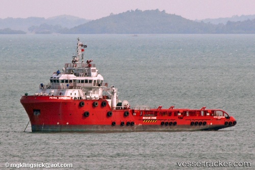
Perdanaexpedition
Current StatusWhere is the vessel?
Perdanaexpedition is currently in Near LABUAN, based on AIS data received about 14h ago.
Latest AIS update:
Current position: 5.26610° N, 115.25814° E (Near LABUAN)
Average speed (last 7 days): Loading…
Average speed (last 30 days): Loading…
Vessel profile: Perdanaexpedition is a Offshore Tug Supply Ship with dimensions 20m x 75m.
This page combines live AIS, route history, probable destination signals, nearby traffic, and port activity for practical vessel monitoring.
The current position of vessel Perdanaexpedition is 5.26610 lat / 115.25814 lng. Updated: 2026-05-20 12:12:11 UTCNearest reference points:
- 44 nm SW of Tembungo
- Near Kikeh
- Near Kota Kinabalu
Details:
Live Vessel Perdanaexpedition Analytics (details, animations, etc.)
Recent AIS points (UTC):
2026-05-20 07:53:04 UTC · 5.26333, 115.25500 · SOG 0 kn · COG -1°2026-05-20 09:45:46 UTC · 5.26494, 115.25407 · SOG 0.9 kn · COG -1°
2026-05-20 10:45:12 UTC · 5.26615, 115.25819 · SOG 0 kn · COG -1°
2026-05-20 12:12:11 UTC · 5.26610, 115.25814 · SOG 0 kn · COG -1°