 vesseltracker.com
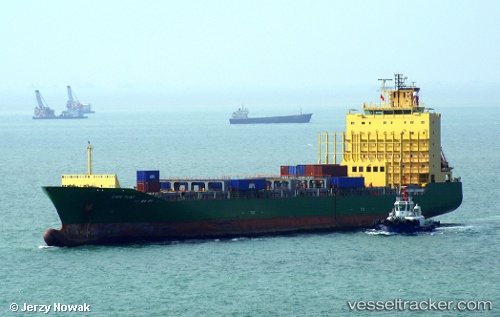
 Cape Flint
Current Status
Where is the vessel?
Cape Flint is currently in 150 nm SE of VISAKHAPATNAM, based on AIS data received about 83d ago.
Latest AIS update:
Current position: 16.47927° N, 85.58581° E (150 nm SE of VISAKHAPATNAM)
Average speed (last 7 days): Loading…
Average speed (last 30 days): Loading…
Vessel profile: Cape Flint is a Container Ship with dimensions 170m x 26m.
This page combines live AIS, route history, probable destination signals, nearby traffic, and port activity for practical vessel monitoring.
The current position of vessel Cape Flint is 16.47927 lat / 85.58581 lng. Updated: 2026-02-04 18:54:49 UTCNearest reference points:
- 112 nm SE of Gopalpur
- Near Wipro Sez/Resapuvanipalem
- Near Vishakhapatnam
Currently sailing under the flag of Marshall Is ![]()
Cape Flint built in 2006 year
Deadweight:
20312 tDetails:
Live Vessel Cape Flint Analytics (details, animations, etc.)
Recent AIS points (UTC):
2026-02-04 18:54:49 UTC · 16.47927, 85.58581 · SOG 7.6 kn · COG 16°