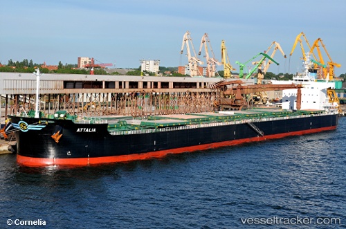
Attalia
Current StatusWhere is the vessel?
Attalia is currently in Near Haldia, based on AIS data received about 14h ago.
Latest AIS update:
Current position: 22.02514° N, 88.08043° E (Near Haldia)
Average speed (last 7 days): Loading…
Average speed (last 30 days): Loading…
Vessel profile: Attalia is a Bulk Carrier with dimensions 32m x 229m.
This page combines live AIS, route history, probable destination signals, nearby traffic, and port activity for practical vessel monitoring.
The current position of vessel Attalia is 22.02514 lat / 88.08043 lng. Updated: 2026-05-21 04:57:16 UTCNearest reference points:
- Near Haldia
- 16 nm SE of Contai
- Near Calcutta
Details:
Live Vessel Attalia Analytics (details, animations, etc.)
Recent AIS points (UTC):
2026-05-21 01:27:23 UTC · 22.03132, 88.08499 · SOG 0 kn · COG 15°2026-05-21 02:21:23 UTC · 22.03133, 88.08496 · SOG 0 kn · COG 16°
2026-05-21 03:45:25 UTC · 22.03132, 88.08499 · SOG 0 kn · COG 16°
2026-05-21 04:57:16 UTC · 22.02514, 88.08043 · SOG 2.4 kn · COG 41°