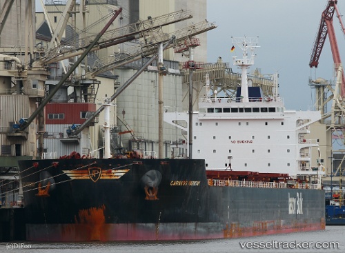
Caravos Harmony
Current StatusWhere is the vessel?
Caravos Harmony is currently in Near Varna, based on AIS data received about 15h ago.
Latest AIS update:
Current position: 43.13156° N, 27.96595° E (Near Varna)
Average speed (last 7 days): Loading…
Average speed (last 30 days): Loading…
Vessel profile: Caravos Harmony is a Bulk Carrier with dimensions 32m x 229m.
This page combines live AIS, route history, probable destination signals, nearby traffic, and port activity for practical vessel monitoring.
The current position of vessel Caravos Harmony is 43.13156 lat / 27.96595 lng. Updated: 2026-05-21 22:52:19 UTCNearest reference points:
- Near Varna
- Near Ignatievo
- Near Beloslav
Details:
Live Vessel Caravos Harmony Analytics (details, animations, etc.)
Recent AIS points (UTC):
2026-05-21 19:13:19 UTC · 43.13169, 27.96664 · SOG 0 kn · COG 339°2026-05-21 19:37:19 UTC · 43.13166, 27.96657 · SOG 0.1 kn · COG 340°
2026-05-21 22:16:19 UTC · 43.13164, 27.96627 · SOG 0 kn · COG 347°
2026-05-21 22:52:19 UTC · 43.13156, 27.96595 · SOG 0.1 kn · COG 353°