 Nikolaos A
Current Status
Where is the vessel?
Nikolaos A is currently in Near Novomoskovsk, based on AIS data received about 14h ago.
Latest AIS update:
Current position: 54.09473° N, 38.23503° E (Near Novomoskovsk)
Average speed (last 7 days): Loading…
Average speed (last 30 days): Loading…
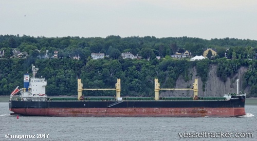
Vessel profile: Nikolaos A is a Bulk Carrier with dimensions 190m x 190m.
This page combines live AIS, route history, probable destination signals, nearby traffic, and port activity for practical vessel monitoring.
The current position of vessel Nikolaos A is 54.09473 lat / 38.23503 lng. Updated: 2026-06-23 12:01:14 UTCNearest reference points:
- 15 nm N of Kalinets
- Near Moskva
Currently sailing under the flag of Marshall Is ![]()
Nikolaos A built in 2009 year
Deadweight:
58133 tDetails:
Live Vessel Nikolaos A Analytics (details, animations, etc.)
Recent AIS points (UTC):
2026-06-23 07:30:27 UTC · 54.09473, 38.23503 · SOG 22 kn · COG 301°2026-06-23 09:56:23 UTC · 54.09483, 38.23486 · SOG 26.5 kn · COG 301°
2026-06-23 10:18:04 UTC · 54.09479, 38.23497 · SOG 24.2 kn · COG 301°
2026-06-23 12:01:14 UTC · 54.09473, 38.23503 · SOG 19.7 kn · COG 301°