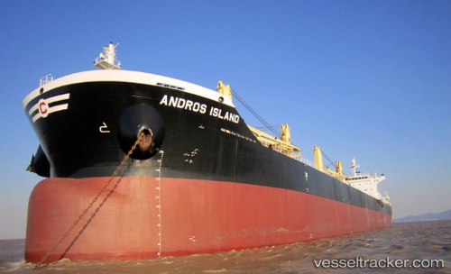
Andros Island
Current StatusWhere is the vessel?
Andros Island is currently in Near Prince Rupert, based on AIS data received about 14h ago.
Latest AIS update:
Current position: 54.33054° N, 130.31046° W (Near Prince Rupert)
Average speed (last 7 days): Loading…
Average speed (last 30 days): Loading…
Vessel profile: Andros Island is a Bulk Carrier with dimensions 32m x 199m.
This page combines live AIS, route history, probable destination signals, nearby traffic, and port activity for practical vessel monitoring.
The current position of vessel Andros Island is 54.33054 lat / -130.31046 lng. Updated: 2026-06-04 14:00:23 UTCNearest reference points:
- Near Prince Rupert
- Near Watson Island
- 11 nm S of Kitimat
Details:
Live Vessel Andros Island Analytics (details, animations, etc.)
Recent AIS points (UTC):
2026-06-04 10:14:25 UTC · 54.33063, -130.31009 · SOG 0.1 kn · COG 243°2026-06-04 10:42:21 UTC · 54.33087, -130.30978 · SOG 0.1 kn · COG 234°
2026-06-04 12:20:26 UTC · 54.33045, -130.31003 · SOG 0.1 kn · COG 230°
2026-06-04 14:00:23 UTC · 54.33054, -130.31046 · SOG 0 kn · COG 227°