 vesseltracker.com
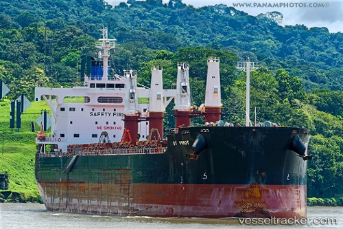
 St Pinot
Current Status
Where is the vessel?
St Pinot is currently in Near Andírrion, based on AIS data received less than 1h ago.
Latest AIS update:
Current position: 38.35612° N, 21.79566° E (Near Andírrion)
Average speed (last 7 days): Loading…
Average speed (last 30 days): Loading…
Vessel profile: St Pinot is a Bulk Carrier with dimensions 190m x 32m.
This page combines live AIS, route history, probable destination signals, nearby traffic, and port activity for practical vessel monitoring.
The current position of vessel St Pinot is 38.35612 lat / 21.79566 lng. Updated: 2026-04-25 21:52:54 UTCNearest reference points:
- Near Káto Achaïa
- Near MESSOLOGGI
- Near Meganísi
Currently sailing under the flag of Marshall Is ![]()
St Pinot built in 2013 year
Deadweight:
57949 tDetails:
Live Vessel St Pinot Analytics (details, animations, etc.)
Recent AIS points (UTC):
2026-04-25 18:08:13 UTC · 38.35606, 21.79533 · SOG 0.1 kn · COG 43°2026-04-25 19:25:39 UTC · 38.35582, 21.79646 · SOG 0.1 kn · COG 9°
2026-04-25 19:58:57 UTC · 38.35598, 21.79587 · SOG 0.2 kn · COG 18°
2026-04-25 21:52:54 UTC · 38.35612, 21.79566 · SOG 0.2 kn · COG 37°