 ARMONIA
Current Status
Where is the vessel?
ARMONIA is currently in Near Vera Cruz, based on AIS data received about 14h ago.
Latest AIS update:
Current position: 12.94543° S, 38.56859° W (Near Vera Cruz)
Average speed (last 7 days): Loading…
Average speed (last 30 days): Loading…
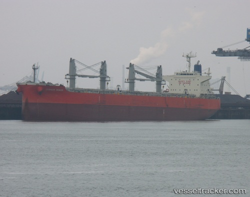
Vessel profile: ARMONIA is a Bulk Carrier with dimensions 197m x 197m.
This page combines live AIS, route history, probable destination signals, nearby traffic, and port activity for practical vessel monitoring.
The current position of vessel ARMONIA is -12.94543 lat / -38.56859 lng. Updated: 2026-07-04 11:04:51 UTCNearest reference points:
- Near Aracaju
- Near Barra dos Coqueiros
Currently sailing under the flag of Marshall Islands ![]()
ARMONIA built in 2013 year
Deadweight:
58609 tDetails:
Live Vessel ARMONIA Analytics (details, animations, etc.)
Recent AIS points (UTC):
2026-07-04 07:40:52 UTC · -12.94214, -38.57095 · SOG 0.1 kn · COG 135°2026-07-04 08:01:51 UTC · -12.94236, -38.57077 · SOG 0.1 kn · COG 127°
2026-07-04 09:52:56 UTC · -12.94154, -38.56936 · SOG 0.2 kn · COG 200°
2026-07-04 11:04:51 UTC · -12.94543, -38.56859 · SOG 0.1 kn · COG 324°