 vesseltracker.com
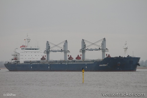
 MINOAS
Current Status
Where is the vessel?
MINOAS is currently in 17 nm NE of Xiaocuo Pt, based on AIS data received about 1h ago.
Latest AIS update:
Current position: 25.33187° N, 120.23493° E (17 nm NE of Xiaocuo Pt)
Average speed (last 7 days): Loading…
Average speed (last 30 days): Loading…
Vessel profile: MINOAS is a Bulk Carrier with dimensions 32m x 190m.
This page combines live AIS, route history, probable destination signals, nearby traffic, and port activity for practical vessel monitoring.
The current position of vessel MINOAS is 25.33187 lat / 120.23493 lng. Updated: 2026-05-14 17:38:09 UTCNearest reference points:
- 21 nm E of Jinjing
- 10 nm N of Xiaocuo Pt
- Near Jinjing
Currently sailing under the flag of Marshall Islands ![]()
MINOAS built in 2011 year
Deadweight:
56952 tDetails:
Live Vessel MINOAS Analytics (details, animations, etc.)
Recent AIS points (UTC):
2026-05-14 14:26:40 UTC · 24.89708, 119.72018 · SOG 11.5 kn · COG 47°2026-05-14 15:33:31 UTC · 25.04182, 119.90403 · SOG 11.9 kn · COG 44°
2026-05-14 16:57:18 UTC · 25.23297, 120.12853 · SOG 12.1 kn · COG 45°
2026-05-14 17:38:09 UTC · 25.33187, 120.23493 · SOG 12 kn · COG 39°