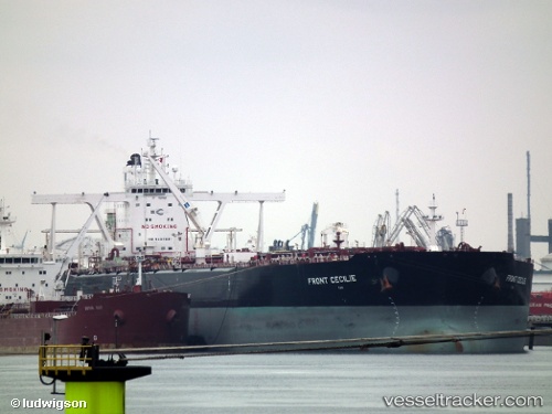
 FRONT CECILIE
Current Status
Where is the vessel?
FRONT CECILIE is currently in Near Mina' al Fahl, based on AIS data received about 15h ago.
Latest AIS update:
Current position: 23.65237° N, 58.54070° E (Near Mina' al Fahl)
Average speed (last 7 days): Loading…
Average speed (last 30 days): Loading…
Vessel profile: FRONT CECILIE is a Crude Oil Tanker with dimensions 60m x 330m.
This page combines live AIS, route history, probable destination signals, nearby traffic, and port activity for practical vessel monitoring.
The current position of vessel FRONT CECILIE is 23.65237 lat / 58.54070 lng. Updated: 2026-05-21 03:44:07 UTCNearest reference points:
- 58 nm S of JASK
- 23 nm NE of Qalhat
- 42 nm SE of Offshore Fujairah
Currently sailing under the flag of Marshall Islands ![]()
FRONT CECILIE built in 2010 year
Deadweight:
296995 tDetails:
Live Vessel FRONT CECILIE Analytics (details, animations, etc.)
Recent AIS points (UTC):
2026-05-21 03:44:07 UTC · 23.65237, 58.54070 · SOG 0.1 kn · COG 102°2026-05-21 03:44:07 UTC · 23.65237, 58.54070 · SOG 0.1 kn · COG 102°
2026-05-21 03:44:07 UTC · 23.65237, 58.54070 · SOG 0.1 kn · COG 102°
2026-05-21 03:44:07 UTC · 23.65237, 58.54070 · SOG 0.1 kn · COG 102°